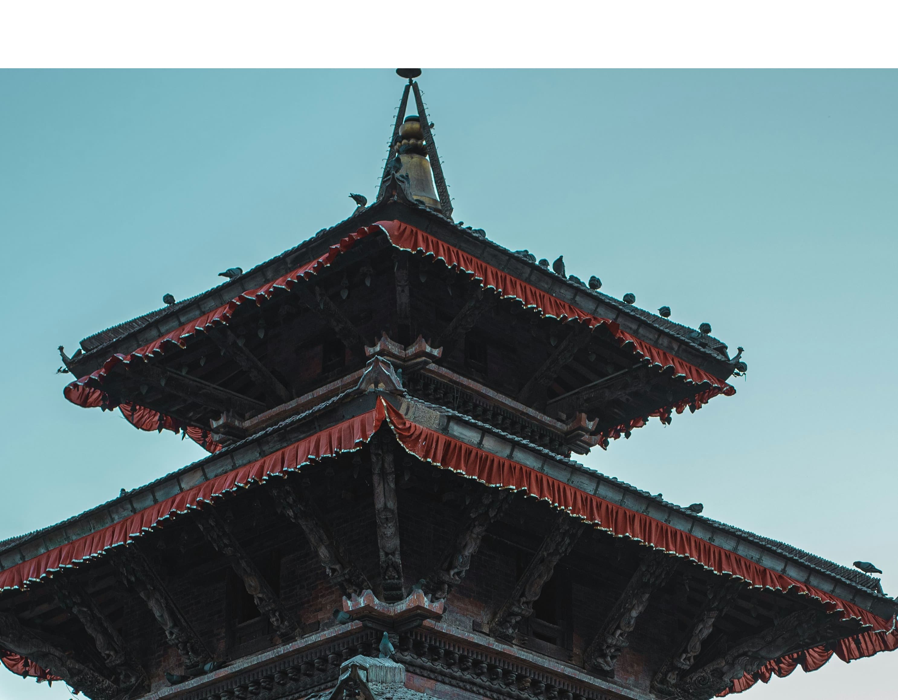
The Annapurna Circuit Trek is an extraordinary journey that circles the Annapurna massif, showcasing the diversity and grandeur of Nepal's landscapes and culture. Starting from Besisahar or Bhulbhule in the Marshyangdi River valley, the trek typically proceeds counter-clockwise due to the gradual ascent and better acclimatization opportunities. The route ascends through lush subtropical forests, terraced rice fields, and alpine meadows to arid desert highlands, providing trekkers with ever-changing backdrops.
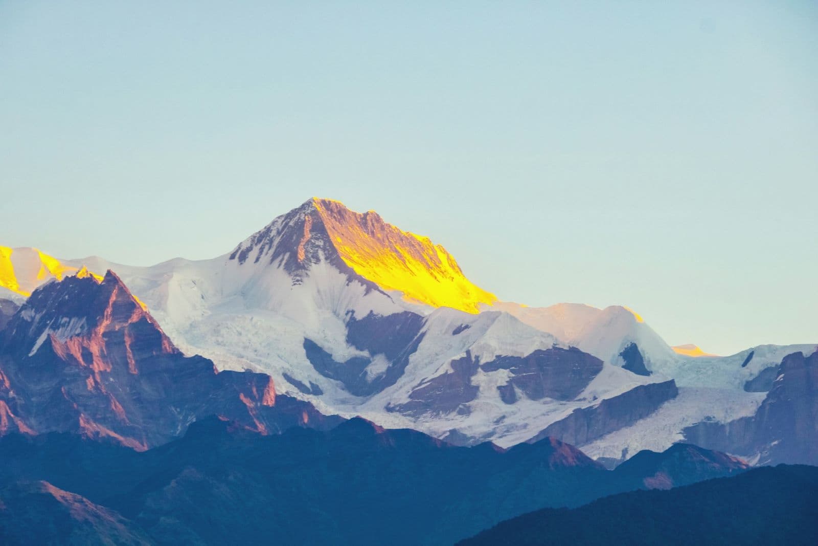
As the trail climbs, it winds through traditional Gurung, Manangi, and Thakali villages, where trekkers can witness local lifestyles and rich cultural practices. The trek includes the crossing of the Thorong La Pass, a high mountain pass reaching an elevation of 5,416 meters (17,769 feet), which offers a challenging yet rewarding experience with panoramic views of the Himalayas.
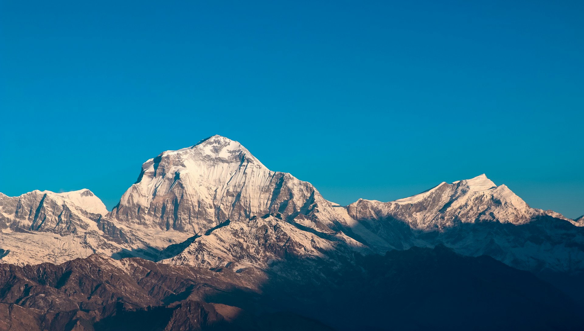
After descending from Thorong La Pass, the path leads to the revered site of Muktinath, an important pilgrimage destination for both Hindus and Buddhists. The trek continues through the Kali Gandaki Gorge, the deepest gorge in the world, towards Tatopani, where natural hot springs provide a much-welcomed opportunity for relaxation. The route then heads up to Ghorepani and Poon Hill, a famed vantage point for spectacular sunrise views over the Annapurna and Dhaulagiri ranges.
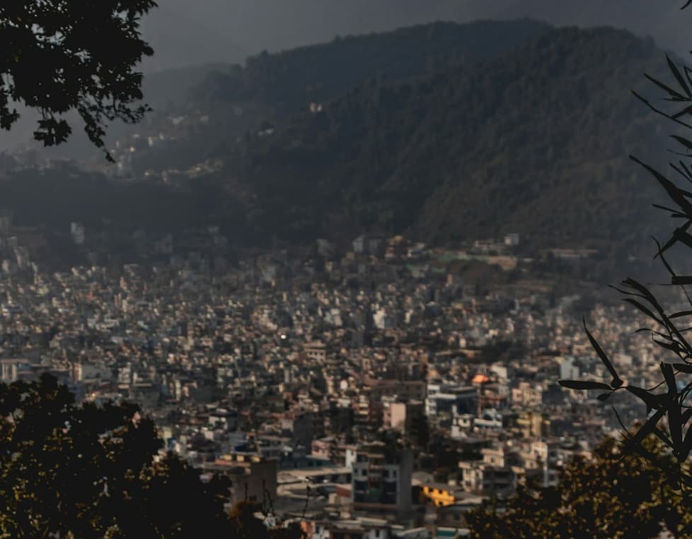
Completing the circuit, the trail loops back to Pokhara, passing through beautiful rhododendron forests and culturally rich villages. The entire journey typically takes around 12 to 21 days, depending on the chosen itinerary and pace, and offers an immersive experience into the heart of the Nepalese Himalayas. With each step, trekkers engage with the natural beauty, the resilience of the high-altitude ecology, and the warmth of the Nepali people, making the Annapurna Circuit Trek one of the most renowned and cherished trekking routes in the world.
Starting to End route place
-
Besisahar/Bhulbhule: Starting point in the Marshyangdi River valley, often reached via a scenic drive from Kathmandu, marking the beginning of the trek.
-
Jagat: A small village offering a true sense of rural Nepalese life and the entry to the Manang district, with its stone houses and terraced fields.
-
Chame: The administrative headquarters of the Manang district, known for its hot springs and stunning views of Lamjung Himal.
-
Pisang: A village split into lower and upper settlements, providing trekkers with their first clear views of the Annapurna range and Pisang Peak.
-
Manang: A culturally rich village allowing for acclimatization with nearby attractions like Gangapurna Glacier Lake and Braga Monastery.
-
Yak Kharka/Ledar: Higher altitude pastures where yaks graze, a critical stop for acclimatization before ascending to Thorong La Pass.
-
Thorong Phedi/High Camp: The last settlement before Thorong La, serving as a base for trekkers preparing to cross the pass.
-
Thorong La Pass: The highest point of the trek at 5,416 meters (17,769 feet), offering a challenging ascent and rewarding panoramic views.
-
Muktinath: A sacred pilgrimage site revered in both Hinduism and Buddhism, known for its eternal flame and 108 water spouts.
-
Kagbeni: A medieval village with narrow alleyways and a gateway to the Upper Mustang, with its red cliffs and the Kali Gandaki River.
-
Marpha: Known as the apple capital of Nepal, offering orchards and local apple products like cider and brandy.
-
Tatopani: Literally meaning 'hot water', it's famous for its natural hot springs, providing a respite for tired trekkers.
-
Ghorepani/Poon Hill: A major highlight for sunrise views over the Annapurna and Dhaulagiri ranges, best observed from Poon Hill's viewpoint.
-
Tadapani/Ghandruk: Trails surrounded by rhododendron forests leading to Ghandruk, a picturesque Gurung village with traditional homes and a cultural museum.
-
Nayapul: The ending point of the trek for many, before driving back to Pokhara, a city known for its serene lakes, vibrant nightlife, and relaxing atmosphere.
This route encapsulates the Annapurna Circuit's rich diversity, taking trekkers through an array of ecosystems, cultural experiences, and some of the most stunning high-altitude scenery on the planet.
Details Route Itinerary
The Annapurna Circuit Trek is a classic trek that circumnavigates the Annapurna Massif, offering a diverse range of landscapes and cultural experiences. Below is a typical day-to-day itinerary for the Annapurna Circuit Trek:
Day 1: Arrival in Kathmandu
- Arrive in Kathmandu, Nepal’s capital and largest city. Spend the day preparing for the trek and enjoying the cultural sights.
Day 2: Kathmandu to Besisahar to Bhulbhule (Drive)
- Drive from Kathmandu to Besisahar and continue to Bhulbhule.
- Altitude: 840 m / 2,756 ft
Day 3: Bhulbhule to Jagat
- Start the trek from Bhulbhule, walking along the Marshyangdi River to Jagat, a small village.
- Altitude: 1,300 m / 4,265 ft
Day 4: Jagat to Dharapani
- Trek from Jagat through forested areas and terraced fields to Dharapani, a large village with diverse ethnic groups.
- Altitude: 1,860 m / 6,102 ft
Day 5: Dharapani to Chame
- Continue from Dharapani to Chame, the administrative center of Manang District, with more prominent views of the Annapurna range.
- Altitude: 2,670 m / 8,760 ft
Day 6: Chame to Pisang
- Trek through a steep and narrow valley to reach Pisang, which offers spectacular mountain vistas.
- Altitude: 3,300 m / 10,827 ft
Day 7: Pisang to Manang
- Head from Pisang to Manang, passing through Upper Pisang and the Tibetan-style village of Braga with its ancient monastery.
- Altitude: 3,540 m / 11,614 ft
Day 8: Acclimatization Day in Manang
- Spend a day in Manang acclimatizing, with optional hikes to Ice Lake or Gangapurna Lake.
- Altitude: 3,540 m / 11,614 ft
Day 9: Manang to Yak Kharka
- Ascend out of Manang to Yak Kharka, an important stop for altitude acclimatization.
- Altitude: 4,110 m / 13,484 ft
Day 10: Yak Kharka to Thorong Phedi
- Trek from Yak Kharka to Thorong Phedi, the base of Thorong La Pass.
- Altitude: 4,600 m / 15,091 ft
Day 11: Thorong Phedi to Muktinath via Thorong La Pass
- Cross Thorong La Pass, the highest point of the trek, and descend to Muktinath, a significant pilgrimage site.
- Altitude: Pass - 5,416 m / 17,769 ft; Muktinath - 3,800 m / 12,467 ft
Day 12: Muktinath to Marpha
- Descend through the dramatic Kali Gandaki Gorge to Marpha, famous for its apple orchards.
- Altitude: 2,670 m / 8,760 ft
Day 13: Marpha to Kalopani
- Continue along the Kali Gandaki river valley, with views of the Annapurna and Dhaulagiri peaks, to Kalopani.
- Altitude: 2,530 m / 8,300 ft
Day 14: Kalopani to Tatopani
- Descend to Tatopani, where you can relax in natural hot springs.
- Altitude: 1,190 m / 3,904 ft
Day 15: Tatopani to Ghorepani
- Climb up to Ghorepani, passing through terraced farmland and rhododendron forests.
- Altitude: 2,850 m / 9,350 ft
Day 16: Ghorepani to Poon Hill to Tadapani
- Early morning hike to Poon Hill for sunrise, then trek to Tadapani.
- Altitude: Poon Hill - 3,210 m / 10,531 ft; Tadapani - 2,710 m / 8,891 ft
Day 17: Tadapani to Ghandruk to Nayapul; Drive to Pokhara
- Trek to Ghandruk, a picturesque Gurung village, continue to Nayapul, and drive to Pokhara.
- Altitude: Pokhara - 830 m / 2,723 ft
Day 18: Pokhara to Kathmandu (Drive or Flight)
- Return to Kathmandu by road or a short flight.
Day 19: Departure from Kathmandu
- Conclude the trek with your departure from Kathmandu.
This itinerary provides a full circuit encompassing the rich geography and culture of the Annapurna region and can be adjusted based on the preferences and pace of the trekking party.
(FAQs) about the Annapurna Circuit Trek along with their answers:
-
What permits do I need for the Annapurna Circuit Trek?
- Answer: You will need two main permits for the Annapurna Circuit Trek: the Annapurna Conservation Area Permit (ACAP) and the Trekkers’ Information Management System (TIMS) card. These permits can be obtained in Kathmandu or Pokhara and are essential for trekking legally and supporting conservation efforts.
-
How long does it take to complete the Annapurna Circuit Trek?
- Answer: The Annapurna Circuit Trek typically takes around 12 to 19 days to complete, depending on your itinerary, speed, and any side trips you choose to take. Some trekkers may choose longer itineraries for more acclimatization time or exploration.
-
What is the best time to trek the Annapurna Circuit?
- Answer: The best times to trek the Annapurna Circuit are during the pre-monsoon spring months of March to May and the post-monsoon autumn months of September to November. These months offer the clearest weather, with the most stable and dry conditions.
-
How difficult is the Annapurna Circuit Trek?
- Answer: The Annapurna Circuit Trek is considered moderate to challenging. It involves long days of walking in diverse terrains, crossing high mountain passes, specifically the Thorong La Pass at 5,416 meters (17,769 feet), and dealing with potential altitude sickness.
-
Is it necessary to hire a guide or can I trek independently?
- Answer: While independent trekking is possible in the Annapurna region, hiring a guide is highly recommended for safety reasons, especially for navigating and understanding the local culture. Guides can be very valuable for their knowledge of the terrain, weather conditions, and assistance in case of emergencies.